Add Data to the Map
Use the catalogue to add Piksel data, or use Upload data to bring in local data and supported web sources.
Add a layer from the catalogue
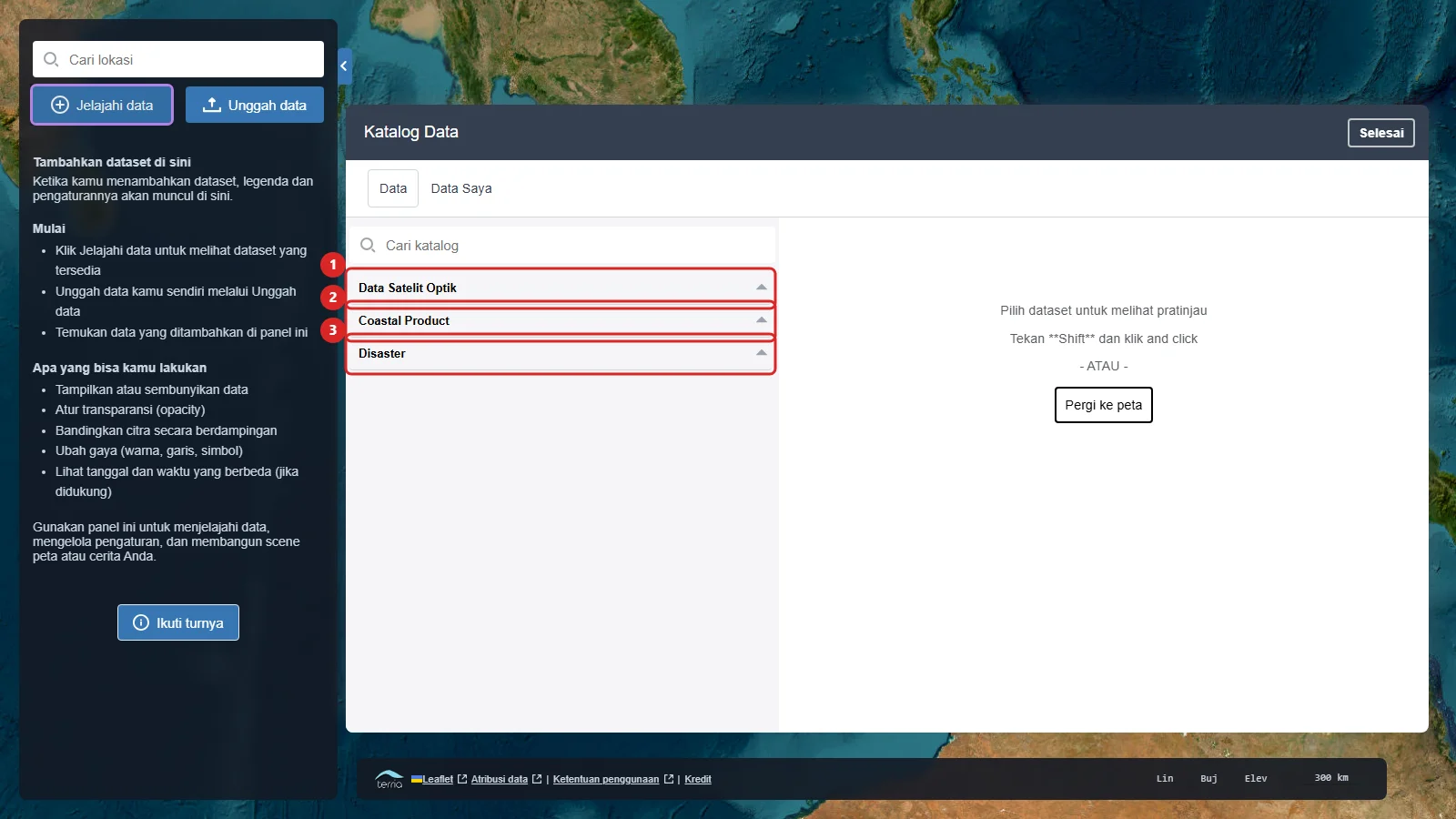
- Click Explore map data in the Workbench.
- Select a suitable category. The catalogue includes Optical Satellite Data, Coastal Product, and Disaster.
- To compare Sentinel-2 mosaics, open Optical Satellite Data → Sentinel-2 Derived Products → Global Sentinel-2 Mosaic.
- Select a layer to display, for example Sentinel-2 Mosaic 2020 (Preview).
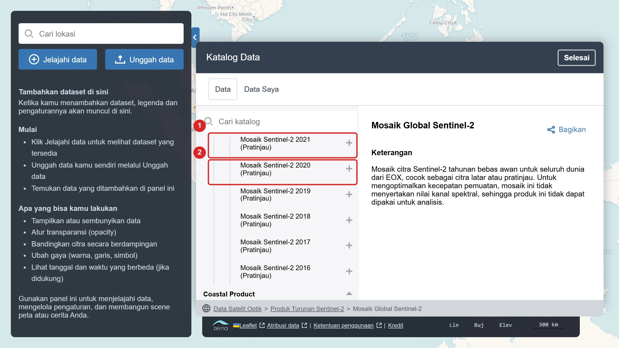
- In the preview panel, click Add to map. Close the catalogue with Go to map.
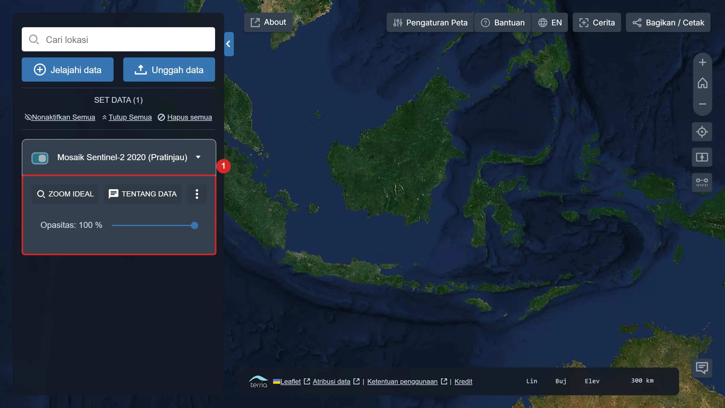
- The layer appears as a Workbench card. Use Ideal zoom to move to its coverage.
Upload your own data
- Click Upload data in the Workbench.
- Choose a file from your computer or enter a supported data-source URL.
- Follow the options shown by Piksel Map to complete the import.
- Added data appears in the Workbench and can be configured like catalogue layers.
Check coverage and time
If a layer is not visible, use Ideal zoom, check its time setting, or select a location inside its coverage.