Searching for Data
This guide walks through finding available satellite data in Data Explorer.
Open Data Explorer
Open the Data Explorer product catalogue.
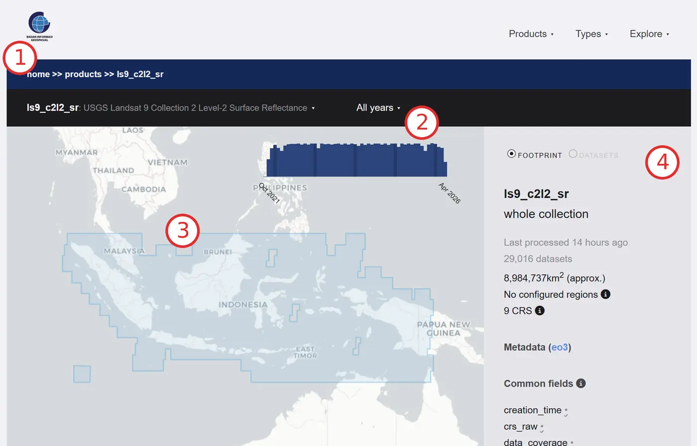
Data Explorer has four main sections:
-
Product selector: Shows the selected product. Select the product name to open the product menu.
-
Time range: Shows the period used to filter the selected product. Select the time range in the grey menu bar to open the time selector. The blue bar chart shows how data availability changes over time.
-
Map view: Shows where data is available for the selected product and period. Blue tiles indicate available data.
-
Product information: Shows further details about the selection, including the number of datasets, their total area and their coordinate reference system.
Select a Product
- Select the product selector, then choose ls9_c2l2_sr (Landsat 9 Surface Reflectance).
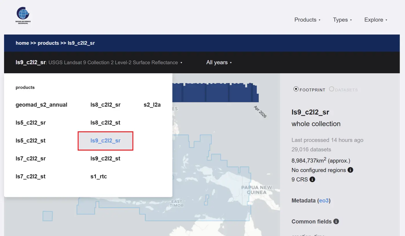
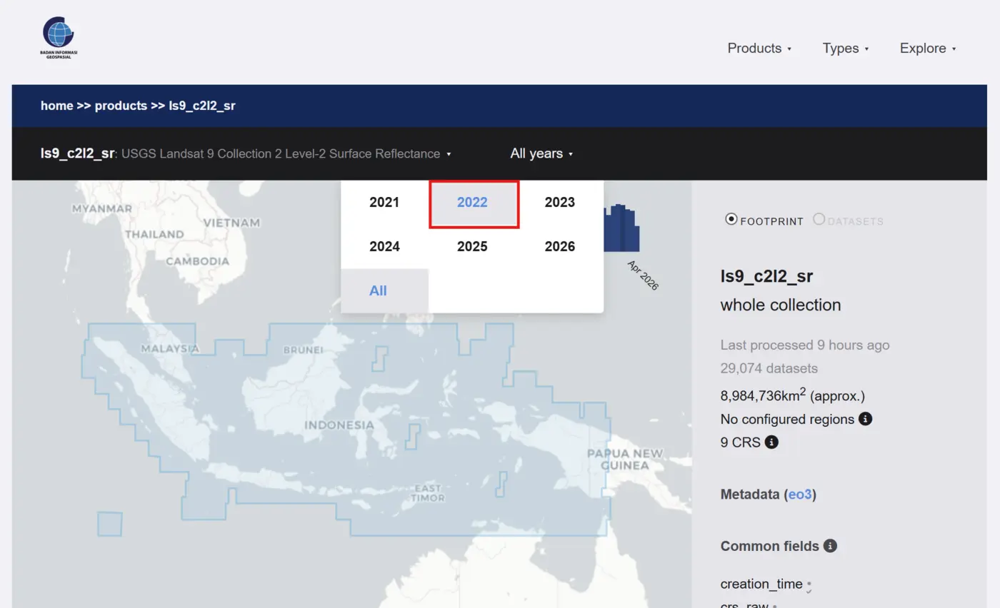
- Select the time bar, then choose 2022 to show Landsat 9 datasets from that year.
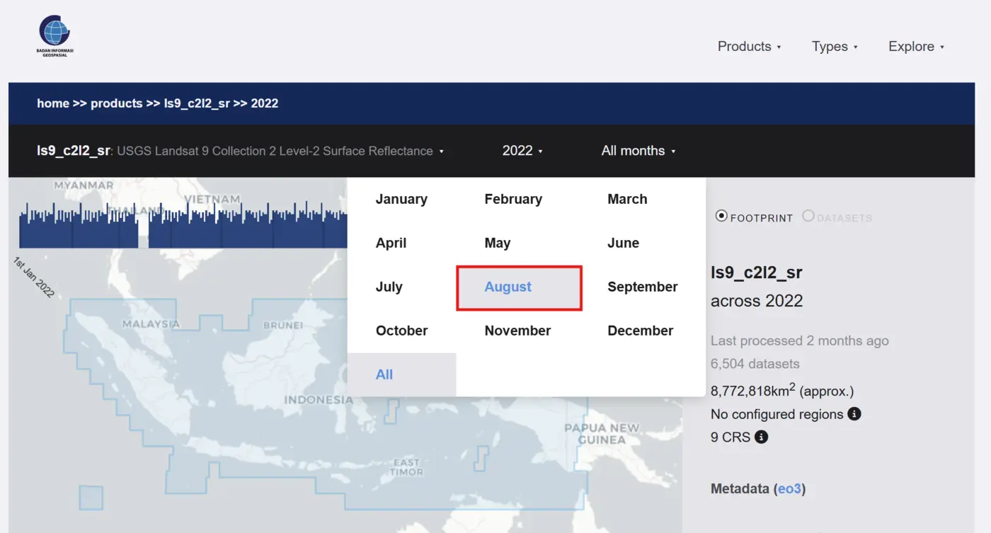
- Select the all months bar, then choose August to narrow the results to August 2022.
- Select the all days bar, then choose 11 to narrow the results to 11 August 2022.
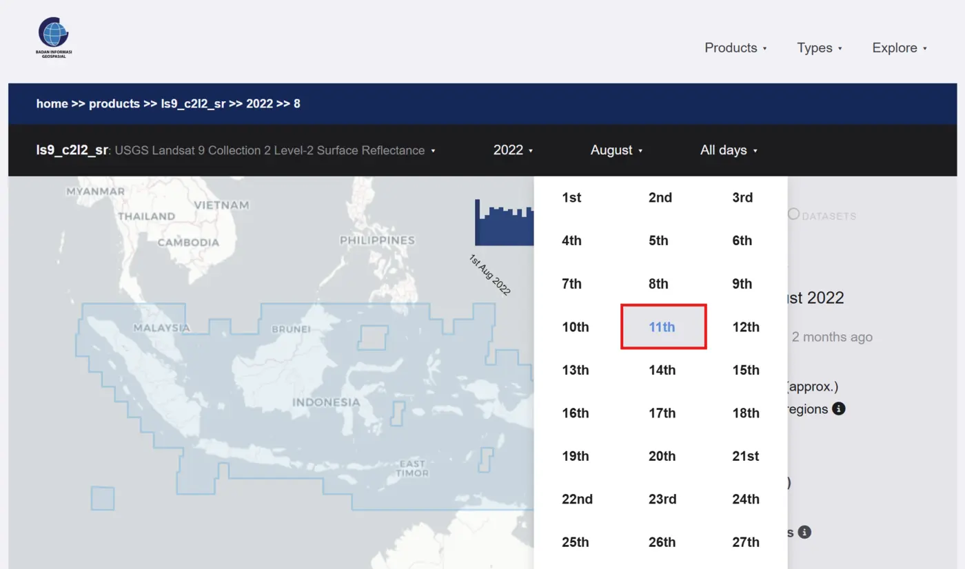
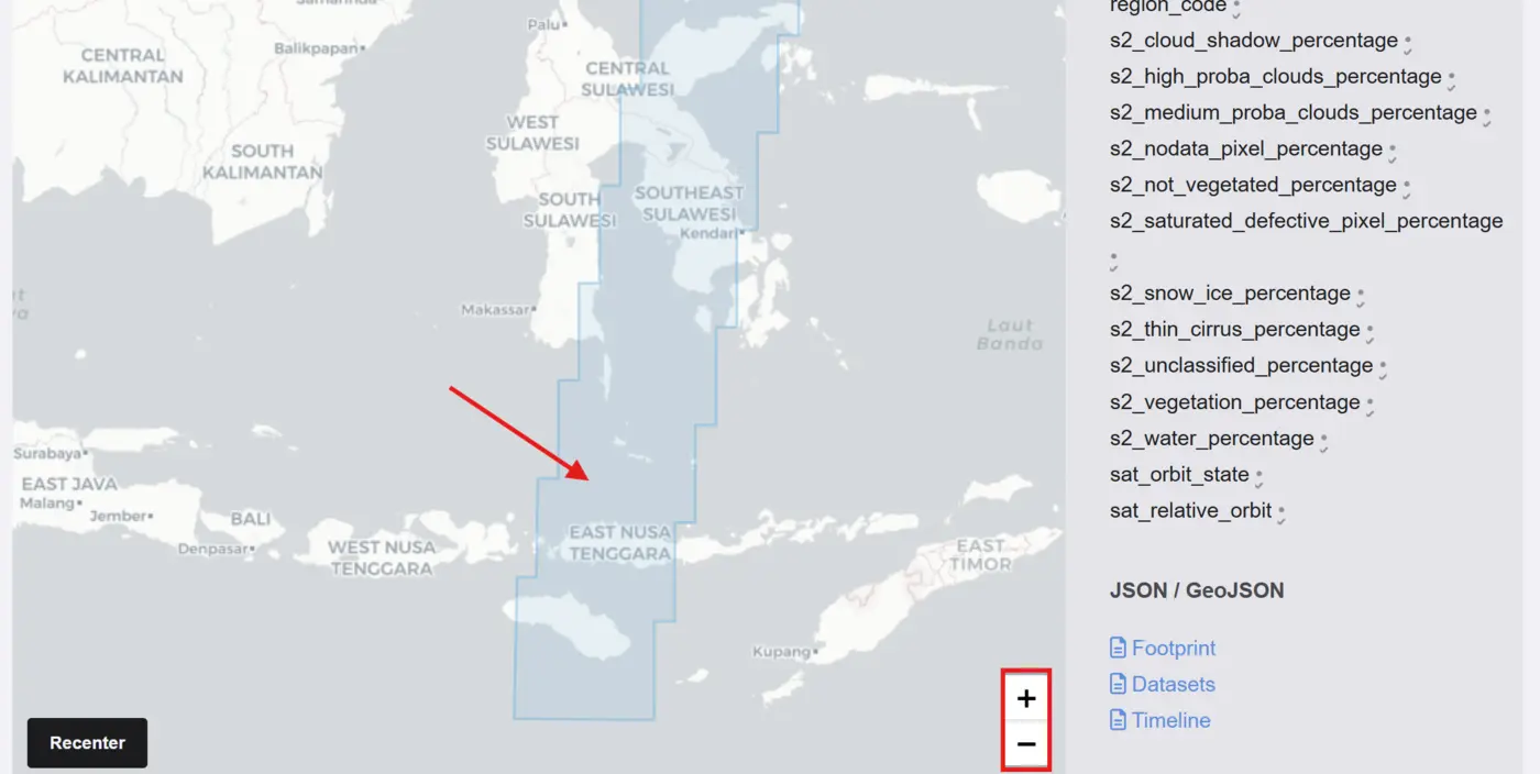
- The map view shows the selected Landsat 9 datasets as blue tiles. Use the + button to zoom in, then select and drag the map to move around.
Zoom to a Specific Region
Use the + button to zoom in on a region. This example uses East Nusa Tenggara.
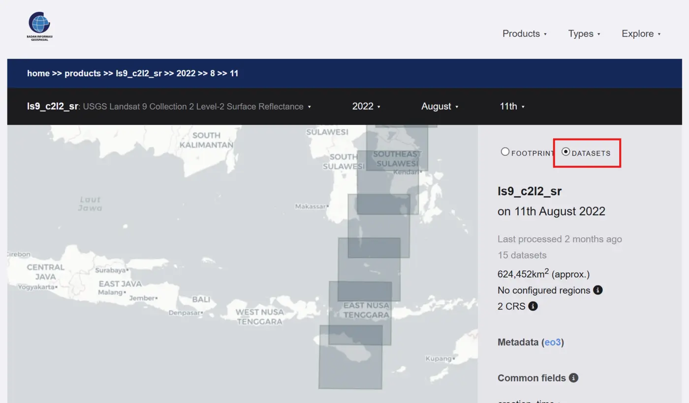
Select a blue tile to open a preview and view the dataset metadata below the map.

Downloading Data
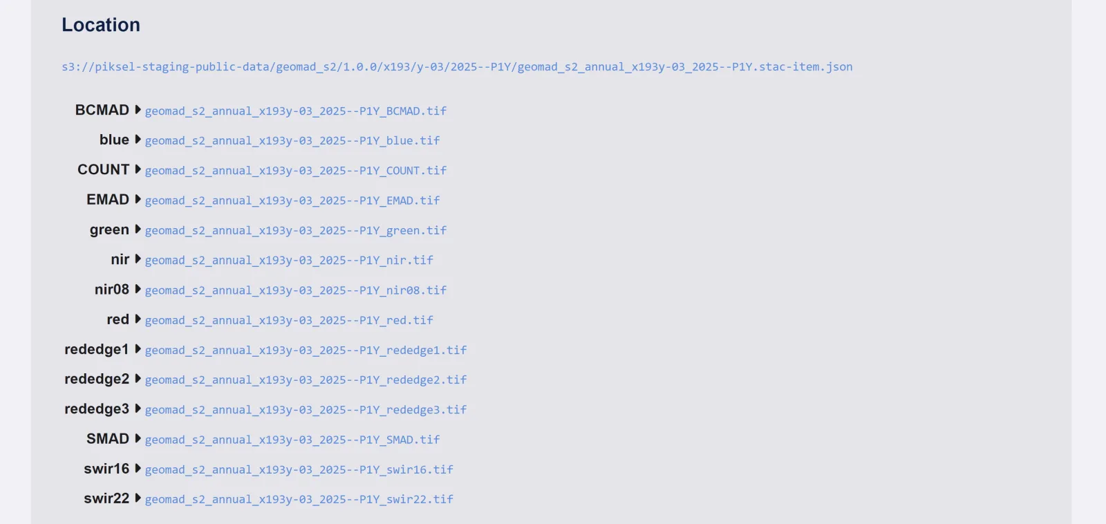
Some datasets, particularly products created by Piksel, provide downloadable files on the dataset details page. Under Location, select a filename to open or download an available asset.
To query the catalogue through code, use the STAC API, or see Data Export Formats for other metadata formats.