Use in GIS Software
Web Services can be used directly from the interface of GIS software by adding the service address to the available connection menu. The menu differs for each service.
| Service | QGIS | ArcGIS Pro | Address |
|---|---|---|---|
| WMS | Add WMS/WMTS Layer | New WMS Server | https://ows.staging.piksel.big.go.id/wms |
| WMTS | Add WMS/WMTS Layer | New WMTS Server | https://ows.staging.piksel.big.go.id/wmts |
| WCS | Add WCS Layer | New WCS Server | https://ows.staging.piksel.big.go.id/wcs |
QGIS
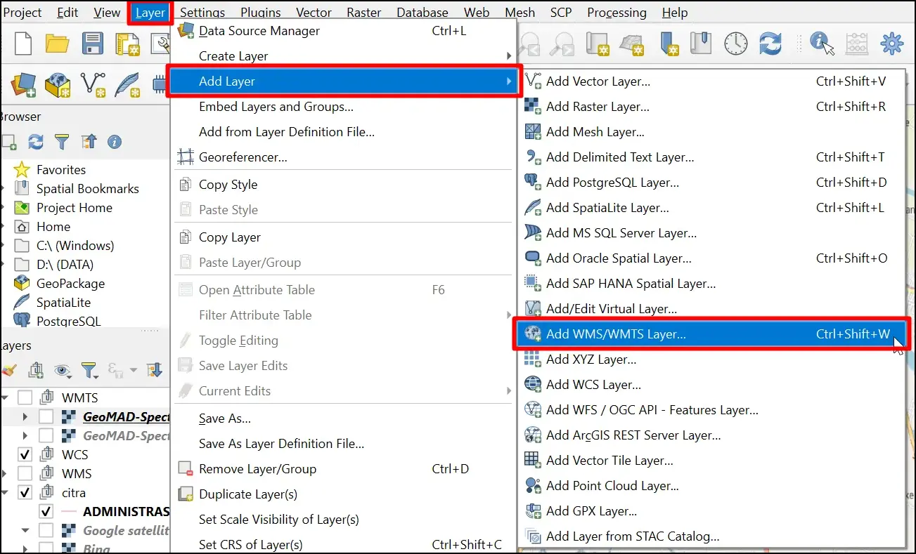
- Select Layer → Add Layer, then choose the menu for the service being used.
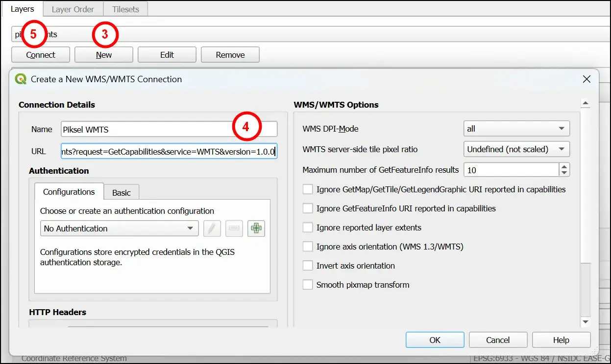
- Click New, then enter the service name and address.
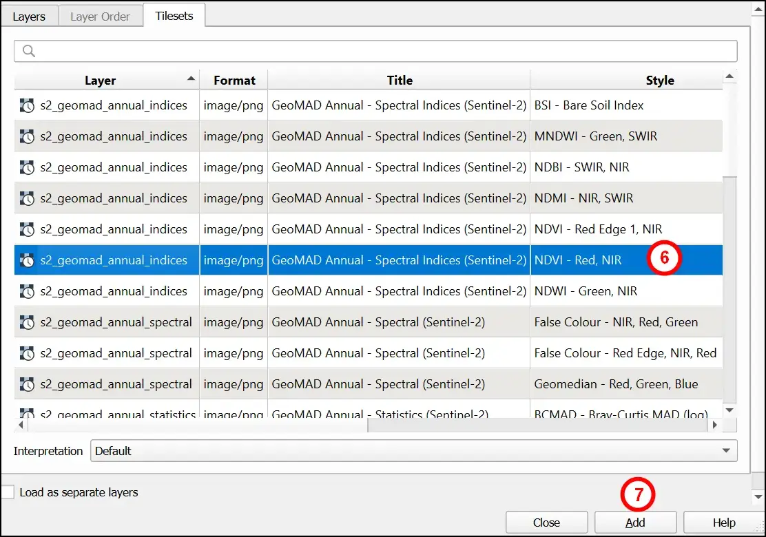
- Click Connect, select an available layer or coverage, then click Add.
ArcGIS Pro
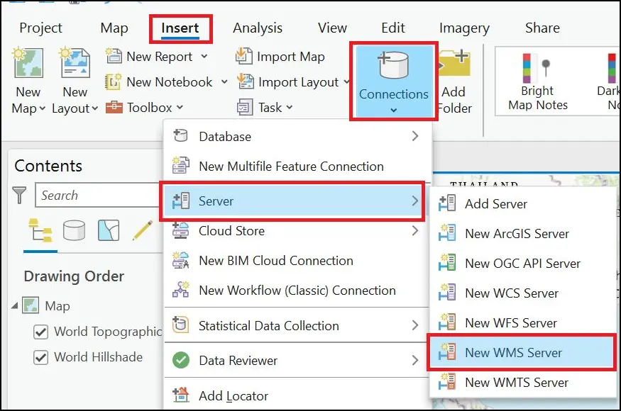
- Select Insert → Connections → Server, then choose the server for the service being used.
- Enter the service address, then click OK.
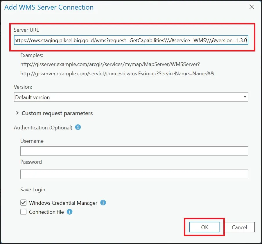
- Select a layer from that connection and add it to the map.