<?xml version="1.0" encoding="utf-8"?>
<feed xmlns="http://www.w3.org/2005/Atom">
    <id>https://piksel.big.go.id/en/blog/</id>
    <title>Piksel Blog</title>
    <updated>2026-07-10T00:00:00.000Z</updated>
    <generator>https://github.com/jpmonette/feed</generator>
    <link rel="alternate" href="https://piksel.big.go.id/en/blog/"/>
    <subtitle>Piksel Blog</subtitle>
    <icon>https://piksel.big.go.id/en/img/favicons/favicon.ico</icon>
    <entry>
        <title type="html"><![CDATA[Working with AI Agents to Advance Piksel]]></title>
        <id>https://piksel.big.go.id/en/blog/ai-agent-pengembangan-piksel/</id>
        <link href="https://piksel.big.go.id/en/blog/ai-agent-pengembangan-piksel/"/>
        <updated>2026-07-10T00:00:00.000Z</updated>
        <summary type="html"><![CDATA[Over the past few months, the Piksel team has started using AI agents to speed up building the platform, from developing applications to processing satellite imagery. The direction and quality of the work still rest with the people behind it.]]></summary>
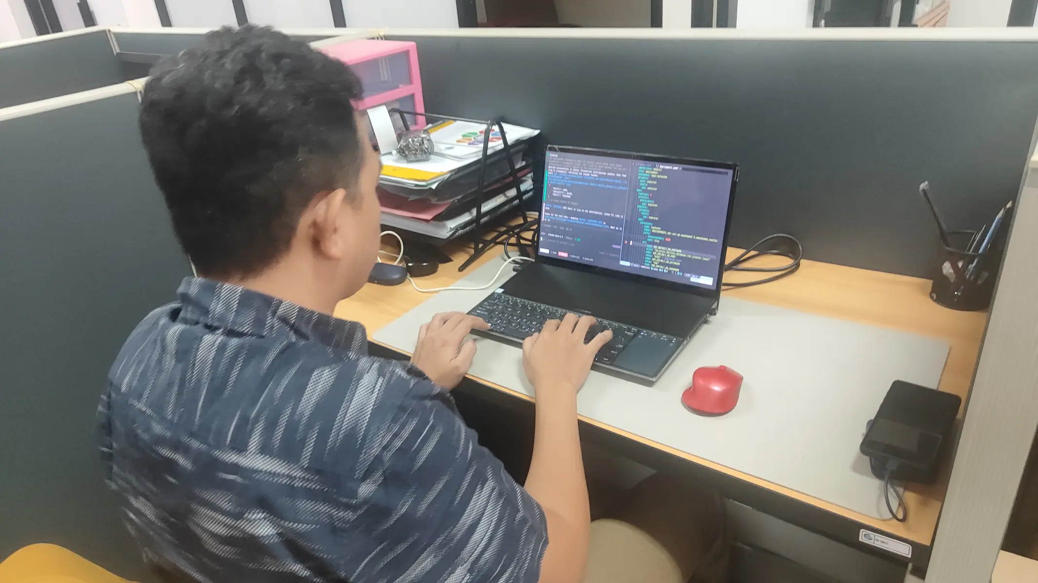
        <content type="html"><![CDATA[<p>Developing Piksel covers a lot of ground, from infrastructure and applications to processing satellite imagery. In recent months, with a small team and limited capacity, the Piksel team has started leaning on AI agents to speed up development that was previously done by hand. Unlike an ordinary chatbot, an AI agent can carry out a sequence of tasks using the tools available to it, so it can work through multi-step jobs more effectively.</p>
<figure style="text-align:center"><img src="https://piksel.big.go.id/img/preview/20260710-pengolahan-ai.webp" alt="The Piksel team using AI agents in platform development" style="width:100%;height:auto"><figcaption>The Piksel team using AI agents in platform development</figcaption></figure>
<p>Muhammad Taufik points to the payoff: an AI agent can grasp complex context, use the tools on hand, and juggle several processes at once. In application development, for instance, it can generate several prototype websites to compare and choose from as needed. That helps the team explore ideas faster, right from the earliest stages of development.</p>
<p>Still, Taufik stresses that an AI agent does not replace the person behind it, because the quality of what it produces depends heavily on how clearly the user frames the context and direction. It can also turn out a lot of convincing-looking output quickly, yet not all of it is relevant or on target, a tendency that has come to be known as "AI slop". That is why the user has to do more than give clear instructions; they need the sense to notice when the AI starts overdoing things or drifting from the goal. This is where a person acts as the quality-control layer, making sure what the AI produces genuinely fits what the development work needs.</p>
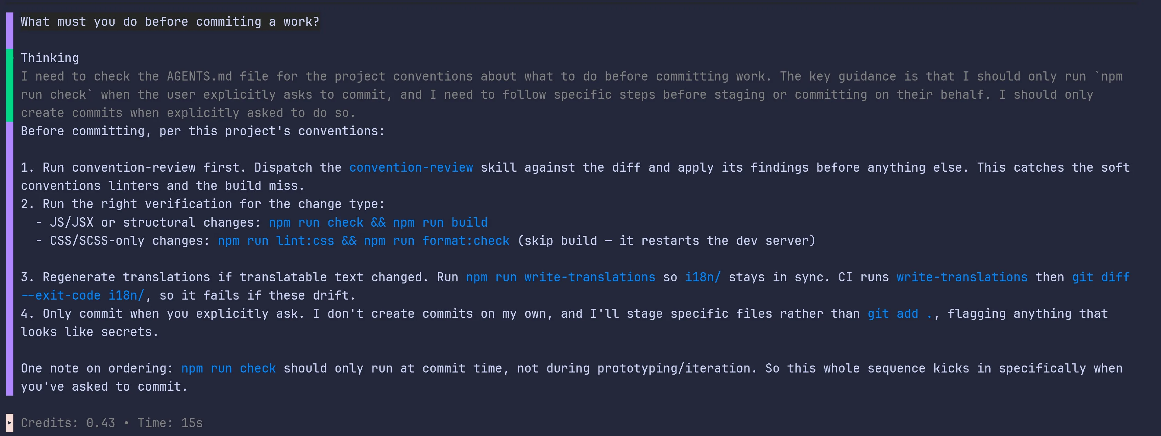
<p>One way the Piksel team keeps that in check is by putting guardrails around the AI agent. Before it is used, the agent is configured to follow the project's development conventions, from coding standards to the steps required before a commit. Within those limits, the code it produces stays clean and free of bugs. On top of that, code that piles up becomes a burden to maintain, so the team still needs to understand the code the AI writes.</p>
<figure style="text-align:center"><img src="https://piksel.big.go.id/img/preview/20260710-agent-context.webp" alt="An AI agent explaining Piksel's pre-commit conventions" style="width:100%;height:auto"><figcaption>An AI agent set up to understand Piksel's context and development conventions</figcaption></figure>
<p>Elgodwistra Kartikoputro has felt the benefit too. In his view, an AI agent helps users explore a range of possible solutions, especially those just finding their way into development. It can also help identify bugs or errors in the code, explain what is causing them, and suggest fixes the developer can test right away.</p>
<p>AI agents have been a real help in speeding up Piksel's fairly complex development, and they make onboarding easier for team members, even those with limited experience, as long as the agents are guardrailed and follow the development conventions. That is why the Piksel team keeps exploring how far AI agents can be put to use.</p>]]></content>
        <author>
            <name>Piksel Team</name>
            <uri>https://pik-sel.id</uri>
        </author>
        <category label="ai" term="ai"/>
        <category label="software-development" term="software-development"/>
    </entry>
    <entry>
        <title type="html"><![CDATA[Turning Thousands of Satellite Images into a Cloud-Free Map of Indonesia]]></title>
        <id>https://piksel.big.go.id/en/blog/geomad-peta-bebas-awan/</id>
        <link href="https://piksel.big.go.id/en/blog/geomad-peta-bebas-awan/"/>
        <updated>2026-07-09T00:00:00.000Z</updated>
        <summary type="html"><![CDATA[Thousands of satellite images are processed into a cloud-free map that shows Indonesia's surface more clearly and consistently, supporting analysis, regional monitoring, and decisions grounded in accurate data.]]></summary>
        <content type="html"><![CDATA[<p>Much of Indonesia sits under heavy cloud cover, which makes analysis from satellite imagery difficult. GeoMAD was built to get around that. It is a composite image derived from the median pixel value of satellite scenes over a set period, an approach that cuts through the cloud and yields a more consistent picture of the land surface. That makes it a valuable source for multi-temporal analysis, from tracking land-cover change to studying regional development and the environment.</p>
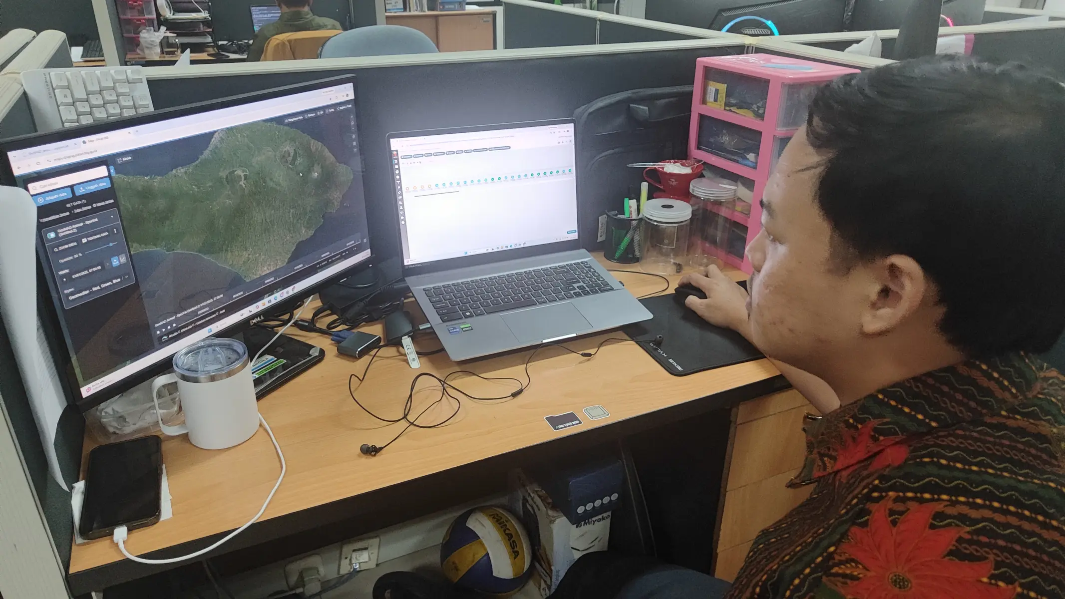
<p>So far, Piksel has produced GeoMAD for all of Indonesia using Sentinel-2 data from 2021 to 2025. Wahyu Lazuardi explained that the processing splits the country into 1,631 tiles of 6 km × 6 km. Working tile by tile lets the data be processed in parallel, so an enormous volume moves through in a relatively short time.</p>
<figure style="text-align:center"><img src="https://piksel.big.go.id/img/preview/20260709-proses-geomad.webp" alt="GeoMAD processing" style="width:100%;height:auto"><figcaption>Processing GeoMAD</figcaption></figure>
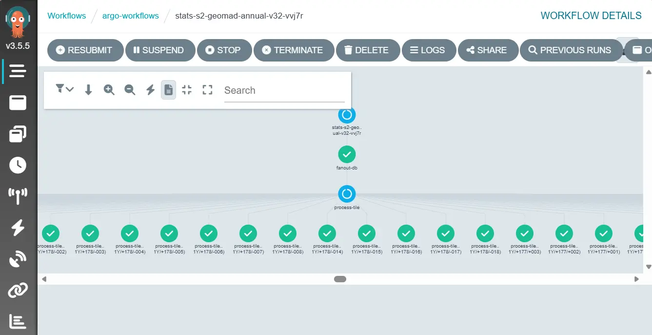
<p>The whole GeoMAD pipeline runs on Argo Workflows across cloud infrastructure, drawing on more than 250 CPUs and 2.5 TB of memory. With that much compute behind it, a full year of national coverage takes about three days to produce. That efficiency means the product can be refreshed regularly to support a range of geospatial analysis needs.</p>
<figure style="text-align:center"><img src="https://piksel.big.go.id/img/preview/20260709-argo.webp" alt="Running Argo Workflows" style="width:100%;height:auto"><figcaption>Running Argo Workflows</figcaption></figure>
<p>Challenges remain. Good data is hard to come by where cloud sits almost permanently, particularly over mountainous terrain. Getting the cloud masking configured well is essential for high-quality imagery, and the compute has to be tuned carefully so national-scale processing stays fast and dependable. These are the problems the team keeps working on to improve GeoMAD's quality and usefulness for Indonesia's geospatial data users.</p>]]></content>
        <author>
            <name>Piksel Team</name>
            <uri>https://pik-sel.id</uri>
        </author>
        <category label="geomad" term="geomad"/>
        <category label="imagery" term="imagery"/>
    </entry>
    <entry>
        <title type="html"><![CDATA[What Satellites Reveal About Indonesia's Changing Coast]]></title>
        <id>https://piksel.big.go.id/en/blog/perubahan-garis-pantai/</id>
        <link href="https://piksel.big.go.id/en/blog/perubahan-garis-pantai/"/>
        <updated>2026-07-08T00:00:00.000Z</updated>
        <summary type="html"><![CDATA[Decades of satellite imagery show how Indonesia's coastline shifts over time. Geospatial analysis on Piksel accurately tracks that change to support coastal management, disaster mitigation, and sustainable development planning.]]></summary>
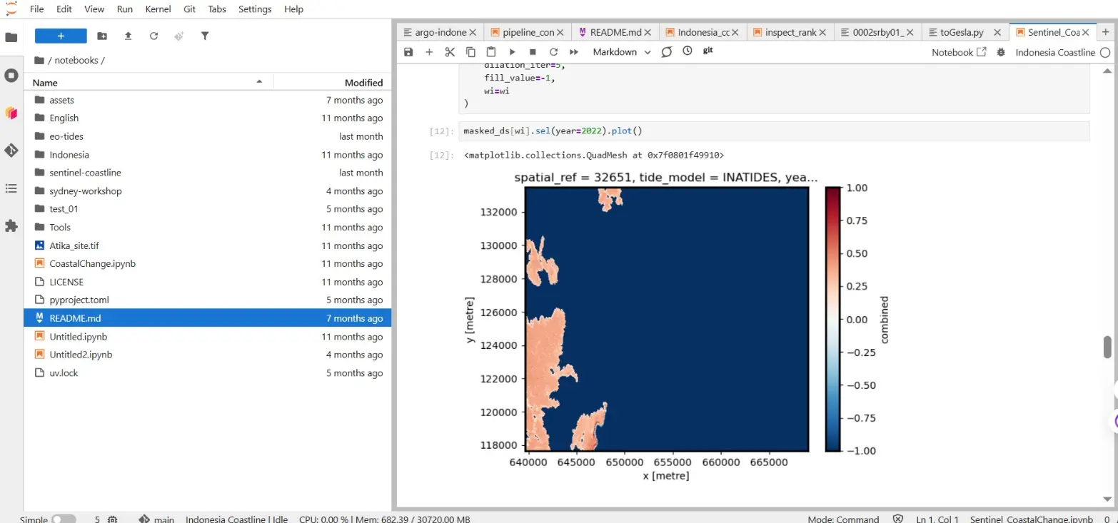
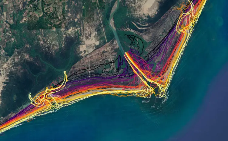
        <content type="html"><![CDATA[<p>Indonesia's coastline is among the most dynamic parts of the country. Erosion, sedimentation, coastal development, and tectonic activity all reshape it, and those shifts reach the communities that live along the shore. Piksel offers coastline-change analysis that lets users trace this movement over time, measured against decades of satellite data.</p>
<figure style="text-align:center"><img src="https://piksel.big.go.id/img/preview/20260708-proses-pengerjaan.webp" alt="Coastline processing workflow on the Piksel platform" style="width:100%;height:auto"><figcaption>Processing coastlines on the Piksel platform</figcaption></figure>
<p>The analysis draws on the Landsat archive, which reaches back to 1984 and runs through 2025. To pin down the coastline more precisely, the imagery is corrected with the Ina-Tides tidal model, which accounts for the sea level at the moment each scene was captured. Land and water are then separated using the Combined Water Index, which pairs the Modified Normalized Difference Water Index (MNDWI) with the Near Infrared (NIR) band to tell the two apart more reliably.</p>
<figure style="text-align:center"><img src="https://piksel.big.go.id/img/preview/20260708-proses.webp" alt="Coastline processing steps" style="width:100%;height:auto"><figcaption>The coastline processing workflow</figcaption></figure>
<p>Those four decades of data bring several benefits for coastal management. Beyond tracking the coastline shifts that affect coastal communities directly, the record makes it possible to measure how fast the shoreline is moving. The analysis has even picked up coastline changes tied to the 2004–2005 Aceh–Nias megathrust earthquakes, which reshaped the shore across several affected areas.</p>
<p>The work is not without its difficulties. Indonesia's waters vary so widely that no single algorithm fits every stretch of coast. Delineation can also go wrong over aquaculture ponds, pools, or lakes, which look spectrally similar to seawater. Choosing an algorithm that suits local conditions is therefore central to producing coastline data accurate and reliable enough to base decisions on.</p>]]></content>
        <author>
            <name>Piksel Team</name>
            <uri>https://pik-sel.id</uri>
        </author>
        <category label="coastline" term="coastline"/>
        <category label="imagery" term="imagery"/>
        <category label="spectral-index" term="spectral-index"/>
    </entry>
    <entry>
        <title type="html"><![CDATA[Training the Next Generation of Geospatial Talent Through BIG's Internship Program]]></title>
        <id>https://piksel.big.go.id/en/blog/program-magang-big-2026/</id>
        <link href="https://piksel.big.go.id/en/blog/program-magang-big-2026/"/>
        <updated>2026-07-08T00:00:00.000Z</updated>
        <summary type="html"><![CDATA[Through hands-on work in a professional setting, BIG's interns build their skills, broaden their perspective, and contribute to the management of geospatial information.]]></summary>
        <content type="html"><![CDATA[<p>To strengthen Indonesia's geospatial ecosystem, BIG keeps building partnerships with universities working on geospatial technology. One of those partnerships is an internship, and this round brought in three geodetic engineering students from Universitas Diponegoro (UNDIP). Over two months, starting 29 June 2026, they worked directly with satellite data and the latest geospatial tools.</p>
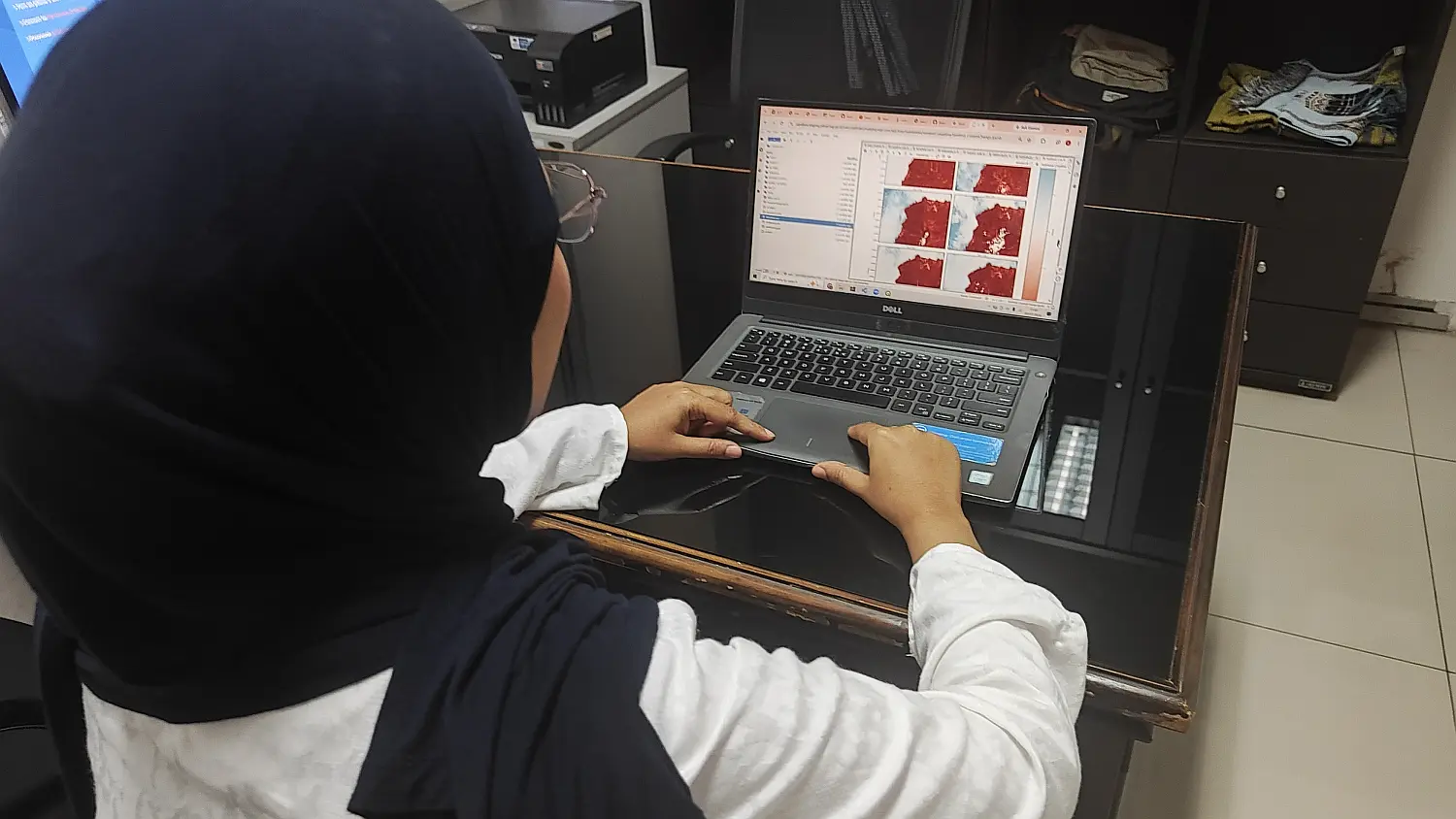
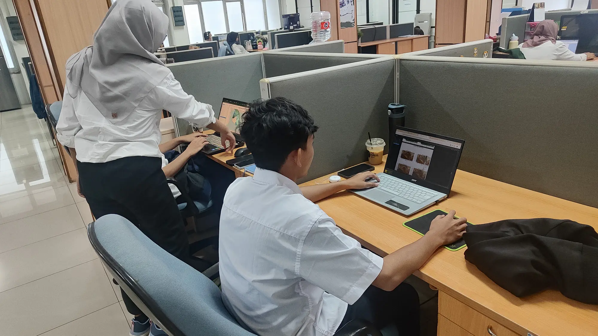
<figure style="text-align:center"><img src="https://piksel.big.go.id/img/preview/20260708-kegiatan-magang.webp" alt="Students practising image processing" style="width:100%;height:auto"><figcaption>Students practising image processing</figcaption></figure>
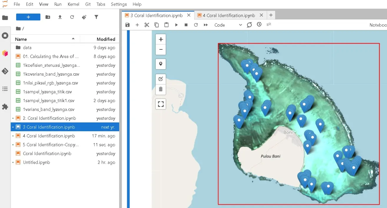
<p>The students took on research topics tied to real needs in natural resource and environmental management: mapping coral reef distribution, detecting oil spills, and running spatio-temporal analysis of mangroves. Sentinel-1 data drove the oil spill detection, while Sentinel-2 supported the coral reef and mangrove work. The projects had them not just learning the theory but applying it to real-world case studies.</p>
<figure style="text-align:center"><img src="https://piksel.big.go.id/img/preview/20260708-hasil-magang2.webp" alt="Sampling with the Piksel platform" style="width:100%;height:auto"><figcaption>Sampling with the Piksel platform</figcaption></figure>
<p>Along the way, the interns got hands-on with cloud-based geospatial processing on Piksel. Laili Nisa found the platform easy to use and much like working in Google Colab. Arva Akhadi explained that before touching the data, they first learned Python as their main tool for analysis; AI, he added, helped a great deal with writing code, though the output still had to be checked for accuracy.</p>
<p>The learning came with its share of obstacles. Nur Afrizal noted that the kernel would sometimes restart mid-processing. The issue was raised with BIG's technical staff, who have since acted on it to improve the service. Through the program, the interns hope to sharpen their geospatial analysis skills and gain practical experience that will serve them in their careers.</p>]]></content>
        <author>
            <name>Piksel Team</name>
            <uri>https://pik-sel.id</uri>
        </author>
        <category label="internship" term="internship"/>
        <category label="training" term="training"/>
        <category label="geospatial" term="geospatial"/>
    </entry>
    <entry>
        <title type="html"><![CDATA[Technical Earth Observation Workshop at the University of Sydney Using the Piksel Platform]]></title>
        <id>https://piksel.big.go.id/en/blog/workshop-observasi-bumi-2026/</id>
        <link href="https://piksel.big.go.id/en/blog/workshop-observasi-bumi-2026/"/>
        <updated>2026-07-07T00:00:00.000Z</updated>
        <summary type="html"><![CDATA[BIG and Geoscience Australia ran a hands-on Earth Observation workshop at the University of Sydney, training staff to process satellite imagery on the Piksel platform.]]></summary>
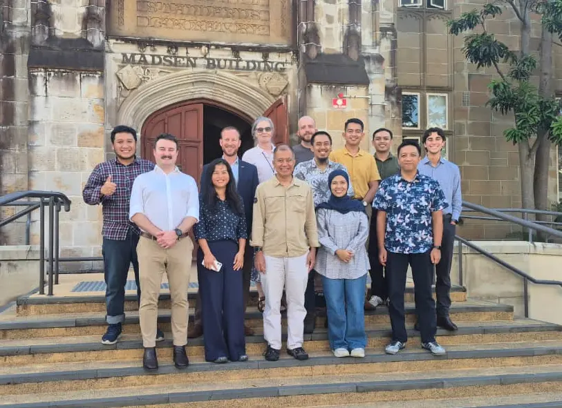
        <content type="html"><![CDATA[<p>BIG staff spent the week of 9–13 February 2026 at the University of Sydney learning to process satellite imagery on the Piksel platform. The Technical Earth Observation Workshop was run with Geoscience Australia (GA), which brought in the expert developers behind Digital Earth Australia.</p>
<figure style="text-align:center"><img src="https://piksel.big.go.id/img/preview/20260707-foto-bareng.webp" alt="BIG and Geoscience Australia participants together at the workshop" style="width:100%;height:auto"><figcaption>BIG and GA participants at the workshop</figcaption></figure>
<p>Seven staff attended from BIG's Directorate of Thematic Mapping (DPT) and its Directorate of Marine and Coastal Topographic Mapping (DPRWLP). The workshop followed on from the Memorandum of Understanding between BIG and GA under the Marine Resources Initiative (MRI), with the University of Sydney facilitating and hosting the event.</p>
<p>Gatot Pramono, Director of Thematic Mapping at BIG, thanked GA and the University of Sydney for their hospitality and collaboration, and for the knowledge and experience shared over the week. Matthew Ellis of GA stressed that the partnership does more than strengthen ties between the two countries; it also makes a tangible contribution to tackling global pressures such as the climate crisis and environmental degradation.</p>
<figure style="text-align:center"><img src="https://piksel.big.go.id/img/preview/20260707-coastline.webp" alt="Coastline analysis produced during the workshop" style="width:100%;height:auto"><figcaption>Coastline analysis</figcaption></figure>
<p>The week was built around hands-on training on the Piksel platform, and it produced two main results: a cloud-free GeoMAD image of Indonesia from Sentinel-2, and a multi-year coastline dataset from Landsat. Both give BIG a foundation for derived products such as land-cover maps and disaster analysis. BIG and GA plan to keep strengthening the collaboration to produce thematic-mapping innovations that support how Indonesia manages its territory and natural resources.</p>]]></content>
        <author>
            <name>Piksel Team</name>
            <uri>https://pik-sel.id</uri>
        </author>
        <category label="workshop" term="workshop"/>
        <category label="training" term="training"/>
    </entry>
    <entry>
        <title type="html"><![CDATA[Piksel Membantu Monitoring Longsoran di Aceh Tengah]]></title>
        <id>https://piksel.big.go.id/en/blog/monitor-longsor-aceh/</id>
        <link href="https://piksel.big.go.id/en/blog/monitor-longsor-aceh/"/>
        <updated>2026-06-29T00:00:00.000Z</updated>
        <summary type="html"><![CDATA[Tanah longsor yang terjadi di Aceh Tengah telah berdampak pada kehidupan masyarakat. Piksel berhasil memonitor perkembangan bencana tersebut. [Foto: Antara/Abiyyu]]]></summary>
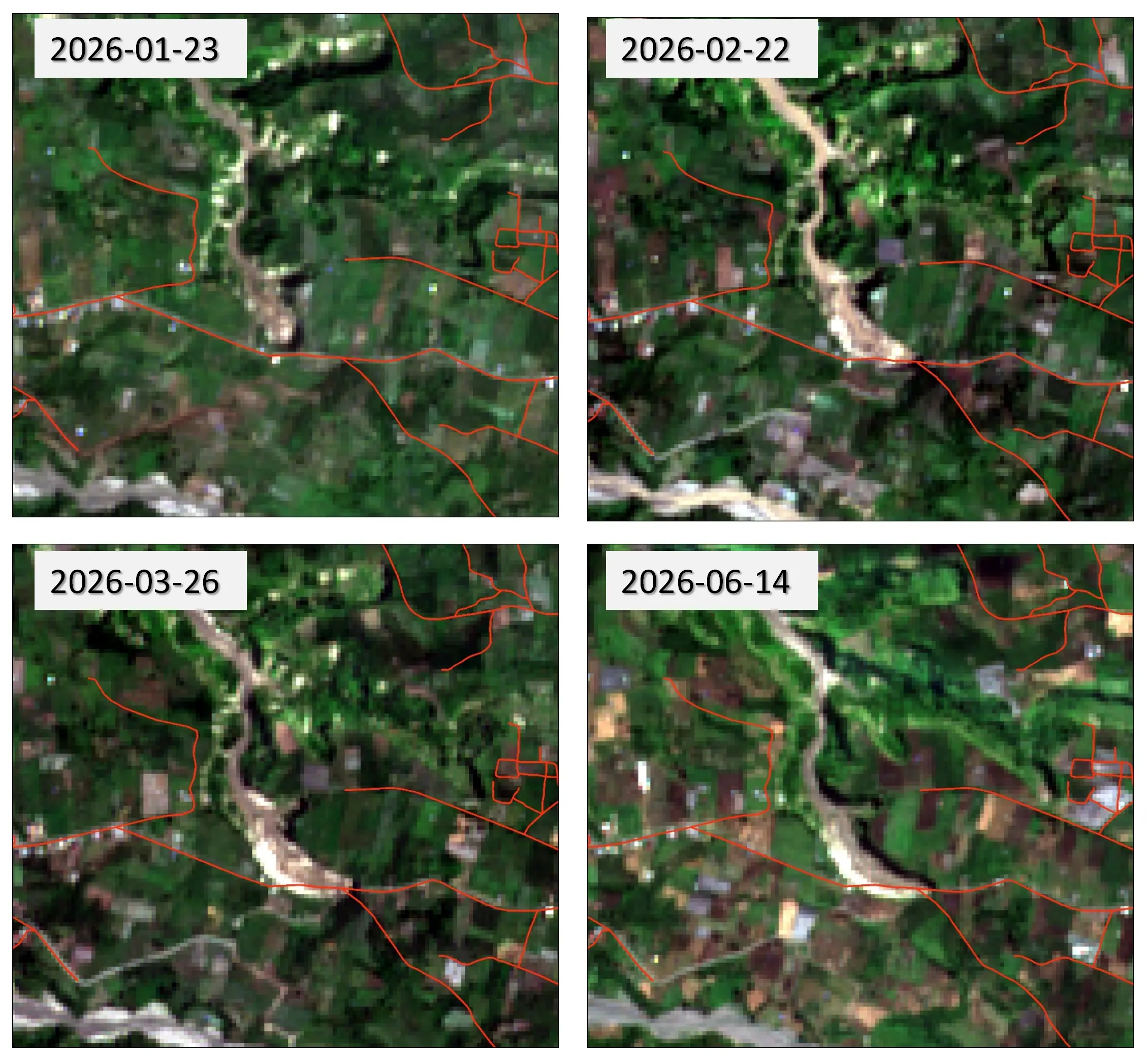
        <content type="html"><![CDATA[<p>Longsoran yang terjadi di Kampung Pondok Balik, Kecamatan Ketol, Kabupaten Aceh Tengah, merupakan fenomena gerakan tanah yang terus berkembang dan menjadi perhatian karena dampaknya terhadap lingkungan serta infrastruktur di sekitarnya. Perubahan bentang lahan yang berlangsung secara progresif telah membentuk area longsoran yang semakin luas dari waktu ke waktu. Untuk memantau perkembangan tersebut, dilakukan analisis menggunakan citra satelit Sentinel-2 yang diakses melalui platform Piksel yang dikembangkan oleh  Direktorat Pemetaan Tematik, Badan Informasi Geospasial.</p>
<figure style="text-align:center"><img src="https://piksel.big.go.id/img/preview/20260629-2-citra.webp" alt="Citra Sentinel 2" style="width:100%;height:auto"><figcaption><strong>Citra Sentinel-2 menunjukkan perubahan longsoran </strong></figcaption></figure>
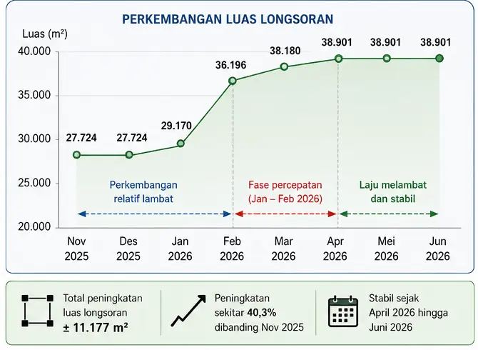
<p>Hasil interpretasi citra Sentinel-2 menunjukkan bahwa luas longsoran di Kampung Pondok Balik relatif stabil pada November–Desember 2025, yaitu sekitar 27.724 m². Memasuki Januari 2026, luas longsoran meningkat menjadi 29.170 m² yang menandakan proses pergerakan tanah masih berlangsung. Perkembangan paling signifikan terjadi antara Januari dan Februari 2026, ketika luas longsoran bertambah sekitar 7.026 m², dari 29.170 m² menjadi 36.196 m². Peningkatan yang cukup tajam ini mengindikasikan adanya fase percepatan aktivitas longsoran yang diduga dipengaruhi oleh tingginya curah hujan dan meningkatnya kejenuhan air dalam tanah.</p>
<figure style="text-align:center"><img src="https://piksel.big.go.id/img/preview/20260629-3-grafik.webp" alt="Perubahan area longsor" style="width:70%;height:auto"><figcaption><strong>Perubahan luas area longsoran (m²)</strong></figcaption></figure>
<p>Pada periode berikutnya, luas longsoran terus bertambah meskipun dengan laju yang lebih rendah, yaitu mencapai 38.180 m² pada Maret 2026 dan 38.901 m² pada April 2026. Setelah itu, tidak teridentifikasi perubahan luas yang signifikan hingga Juni 2026. Secara keseluruhan, area longsoran mengalami peningkatan sekitar 11.177 m² atau 40,3% dibandingkan kondisi awal pemantauan. Stabilnya luas longsoran sejak April hingga Juni 2026 menunjukkan bahwa aktivitas perluasan area longsoran mulai melambat, meskipun kondisi lereng masih perlu dipantau untuk mengantisipasi kemungkinan reaktivasi pada musim hujan berikutnya.</p>
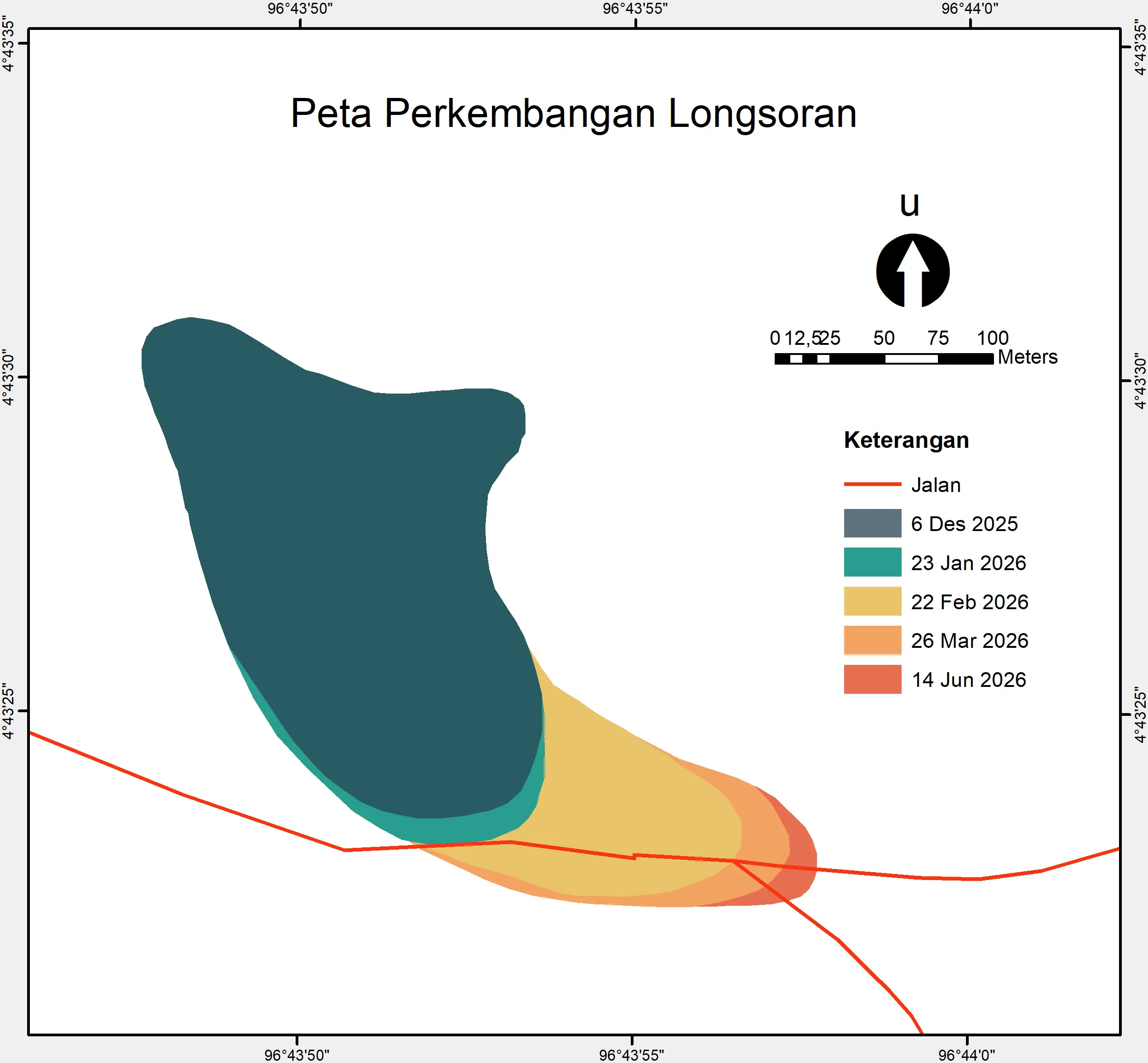
<p>Peta hasil pemantauan memperlihatkan bahwa perubahan area longsoran tidak hanya terjadi pada bagian inti longsoran, tetapi juga berkembang ke arah luar membentuk perluasan yang cukup jelas pada sisi selatan dan tenggara. Tumpang susun batas longsoran dari setiap periode pengamatan menunjukkan pola pertumbuhan yang konsisten, dengan area terdampat semakin meluas dari bulan ke bulan. Informasi ini memberikan gambaran yang lebih jelas mengenai arah perkembangan longsoran dan wilayah yang berpotensi terdampak pada masa mendatang.</p>
<figure style="text-align:center"><img src="https://piksel.big.go.id/img/preview/20260629-1-peta.webp" alt="Peta longsor" style="width:80%;height:auto"><figcaption><strong>Peta perkembangan area longsoran periode Desember 2025 – Juni 2026</strong></figcaption></figure>
<p>Perkembangan spasial yang terekam pada peta menunjukkan bahwa perluasan longsoran cenderung bergerak mengikuti zona lereng yang lebih rendah. Area yang mengalami penambahan luas terbesar berada pada bagian kaki longsoran, yang mengindikasikan adanya perpindahan material ke arah bawah lereng. Pola tersebut menunjukkan bahwa proses gerakan tanah masih aktif meskipun laju perkembangannya mulai menurun pada periode akhir pemantauan.</p>
<p>Salah satu temuan penting dari hasil pemetaan adalah hubungan antara perkembangan longsoran dan terputusnya Jalan Simpang Balik-Blang Mancung. Peta menunjukkan bahwa area longsoran terus bergerak mendekati koridor jalan sehingga jarak antara tepi longsoran dan badan jalan semakin berkurang. Kondisi ini meningkatkan tingkat kerentanan infrastruktur transportasi terhadap kerusakan, baik berupa retakan, penurunan badan jalan, maupun gangguan akses apabila terjadi perkembangan longsoran lanjutan.</p>
<p>Hasil pemantauan berbasis citra satelit Sentinel-2 menunjukkan bahwa metode penginderaan jauh mampu memberikan informasi yang efektif untuk memantau dinamika longsoran secara berkala. Data yang diperoleh tidak hanya menggambarkan perubahan luas area terdampak, tetapi juga menunjukkan arah perkembangan longsoran dan potensi ancamannya terhadap infrastruktur. Informasi tersebut dapat menjadi dasar penting dalam mendukung kegiatan mitigasi bencana, perencanaan penanganan, serta pengambilan keputusan bagi pemerintah dan pemangku kepentingan dalam upaya mengurangi risiko bencana di kawasan Pondok Balik, Kecamatan Ketol, Kabupaten Aceh Tengah.</p>]]></content>
        <author>
            <name>Piksel Team</name>
            <uri>https://pik-sel.id</uri>
        </author>
        <category label="platform" term="platform"/>
        <category label="bencana" term="bencana"/>
        <category label="longsor" term="longsor"/>
        <category label="monitoring" term="monitoring"/>
    </entry>
</feed>